


Angra do Heroísmo, Azores, 02 Oct 2019 (Lusa)
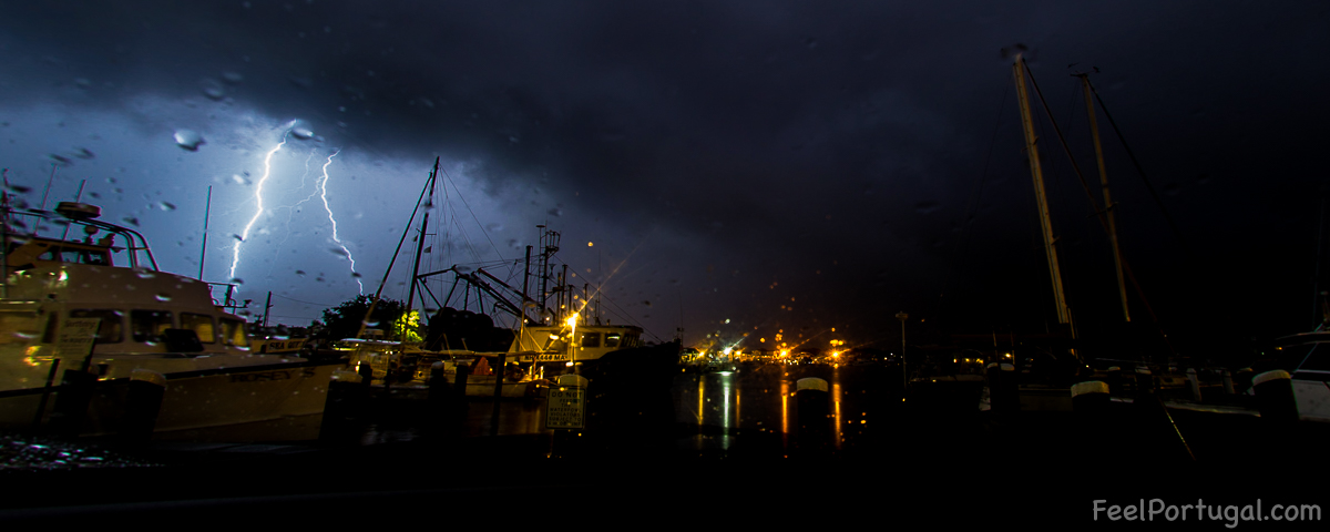
Nearly 1,000 operatives, including firefighters, civil servants, health professionals, and security forces, are on standby today in the early hours of the Azores to respond to the passage of hurricane “Lorenzo” through the archipelago.
“We have 350 firefighters ready to operate throughout the archipelago. If we can count on all the operatives who are on alert and in prevention, all the areas of the different regional directorates, such as Public Works, Forestry Services, Environment, Armed Forces, PSP, and GNR, we can say that we are very close to the 1,000 operatives ready or preventive to act,” said the president of Civil Protection of the Azores, Carlos Neves.
The greater proximity of the center of Hurricane “Lorenzo” to the island of Flores should be recorded by 06:00 local time today (07:00 in Lisbon), told Lusa the local delegate of the Portuguese Institute of the Sea and Atmosphere (IPMA).
By that time, the center of the hurricane should be approximately 100 kilometers (km) west of the island of Flores, said Carlos Ramalho.


The “Lorenzo” will affect the entire archipelago, but “especially” this island and that of Corvo, also indicates the IPMA, underlining that the effects of the storm will begin to feel progressively early in the morning and Wednesday morning, before and after the greater proximity of the center of the hurricane to Flores, therefore.
According to Carlos Neves, the worsening of the state of the sea raises “concerns”, but preventive measures have been taken, such as the closure of sections by the sea and the removal of boats to land.
“We believe that every possible precaution has been taken. We do not know if the force of the sea will cause damage to port infrastructure,” he said.
The president of the Regional Civil Protection and Fire Service of the Azores also said that “some people have been relocated in the municipality of Praia da Vitória”, by the municipality, as a preventive measure, “because they live in degraded housing”.
Other Feel Portugal articles
- The Azores and Diaspora Media Organizations Sign Content Sharing Platform in New Bedford
- This Donkey Sanctuary is a Tourist Attraction in the Azores
- Emotional pilgrims fulfill promises to the Holy Christ
- Azores/earthquakes: Situation stabilized but help may be mobilized if needed
- Merchant ship fire near Faial island in the Azores
For the islands of Flores and Corvo (Western group), the southwest wind is expected to turn northwest with gusts in the order of 190 km / h (with a probability of 40% of the maximum gusts being greater than 200 km / h), rain sometimes strong and waves south passing southwest, with significant height between 10 and 15 meters. The maximum wave height can reach 25 meters.
For the Central Group (Pico, São Jorge, Faial, Graciosa, and Terceira) is expected southwest wind with gusts up to 160 km/h, periods of rain and waves southwest passing west with a significant height between nine and 12 meters, and the maximum wave height may reach 22 meters.
In the islands of the Eastern group – São Miguel and Santa Maria – there should be south wind running west with gusts up to 100 km / h, periods of rain and southwest waves with a significant height between seven and nine meters.
Ver artigo em Português
Açores/Mau tempo: Cerca de 1.000 operacionais de prevenção na passagem do furacão “Lorenzo”
Angra do Heroísmo, Açores, 02 out 2019 – Perto de 1.000 operacionais, entre bombeiros, funcionários públicos, profissionais de saúde e forças de segurança, estão de prevenção hoje de madrugada nos Açores para dar resposta à passagem do furacão “Lorenzo” pelo arquipélago.
“Temos 350 bombeiros prontos para atuar em todo o arquipélago. Se contarmos com todos os operacionais que estão de alerta e em prevenção, todas as áreas das diferentes direções regionais, como as Obras Públicas, os Serviços Florestais, o Ambiente, as Forças Armadas, a PSP e a GNR, podemos dizer que chegamos muito perto dos 1.000 operacionais prontos ou de prevenção para atuarem”, adiantou o presidente da Proteção Civil dos Açores, Carlos Neves.
A maior proximidade do centro do furacão “Lorenzo” à ilha das Flores deve registar-se pelas 06:00 locais de hoje (07:00 em Lisboa), disse à Lusa o delegado local do Instituto Português do Mar e da Atmosfera (IPMA).
Por aquela hora, o centro do furacão deve estar a aproximadamente 100 quilómetros (km) a oeste da ilha das Flores, declarou Carlos Ramalho.
O “Lorenzo” irá afetar todo o arquipélago, mas “especialmente” esta ilha e a do Corvo, indica ainda o IPMA, sublinhando que os efeitos da tempestade começarão a sentir-se progressivamente madrugada dentro e na manhã de quarta-feira, antes e depois da maior proximidade do centro do furacão às Flores, portanto.
Segundo Carlos Neves, o agravamento do estado do mar levanta “preocupações”, mas foram tomadas medidas de prevenção, como o encerramento de troços junto ao mar e a remoção de embarcações para terra.
“Pensamos que foram tomadas todas as precauções possíveis. Não sabemos se a força do mar poderá vir a causar danos nas infraestruturas portuárias”, afirmou.
O presidente do Serviço Regional de Proteção Civil e Bombeiros dos Açores disse ainda que “foram realojadas algumas pessoas no concelho da Praia da Vitória”, pela município, como medida de prevenção, “por viverem em habitações degradadas”.
Outros artigos no Feel Portugal
- The Azores and Diaspora Media Organizations Sign Content Sharing Platform in New Bedford
- This Donkey Sanctuary is a Tourist Attraction in the Azores
- Emotional pilgrims fulfill promises to the Holy Christ
- Azores/earthquakes: Situation stabilized but help may be mobilized if needed
- Merchant ship fire near Faial island in the Azores
Para as ilhas das Flores e do Corvo (grupo Ocidental), prevê-se vento sueste rodando para noroeste com rajadas na ordem dos 190 km/h (com uma probabilidade de 40% de a rajada máxima ser superior a 200 km/h), chuva por vezes forte e ondas de sul passando a sudoeste, com altura significativa entre 10 e 15 metros. A altura máxima de onda pode atingir os 25 metros.
Já para o grupo Central (Pico, São Jorge, Faial, Graciosa e Terceira) é esperado vento sudoeste com rajadas até 160 km/h, períodos de chuva e ondas de sudoeste passando a oeste com altura significativa entre nove e 12 metros, podendo a altura máxima de onda atingir os 22 metros.
Nas ilhas do grupo Oriental – São Miguel e Santa Maria – deverá haver vento sul rodando para oeste com rajadas até 100 km/h, períodos de chuva e ondas de sudoeste com altura significativa entre sete e nove metros.
CYB (PPF) // FST
Lusa/fim


")

